Welcome to Malibu
Malibu is an affluent beachfront city in northwestern Los Angeles County, California, United States. As of the 2010 census, the city population was 12,645. Malibu consists of a 21-mile (34 km) strip of prime Pacific coastline. Nicknamed “the ‘Bu” by surfers and locals, the community is famous for its warm, sandy beaches, and for being the home of many Hollywood movie stars and others associated with the entertainment industry. Signs around the city proclaim “27 miles of scenic beauty”, referring to Malibu’s original length of 27 miles (43 km) before the city was incorporated in 1991.
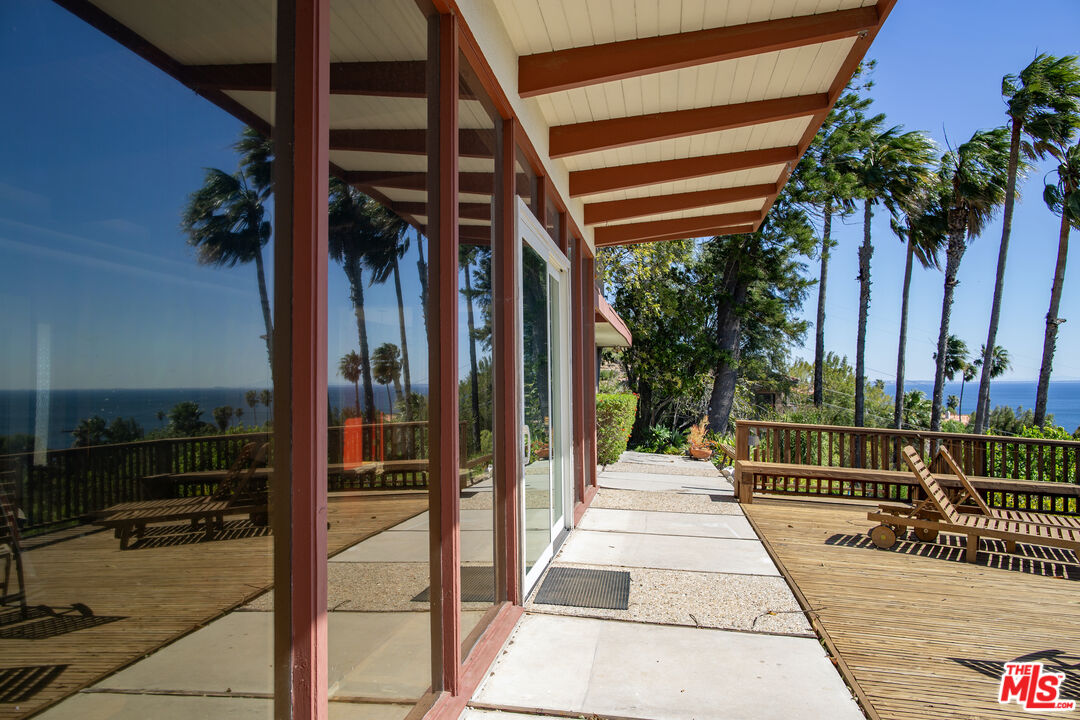
Most Malibu residents live within a few hundred yards of Pacific Coast Highway (State Route 1), which traverses the city, with some residents living up to a mile away from the beach up narrow canyons, and many more residents of the unincorporated canyon areas identifying Malibu as their hometown. The city is also bounded (more or less) by Topanga Canyon to the East, the Santa Monica Mountains consisting of Agoura Hills, Calabasas, and Woodland Hills to the North, the Pacific Ocean to the South, and Ventura County to the West.
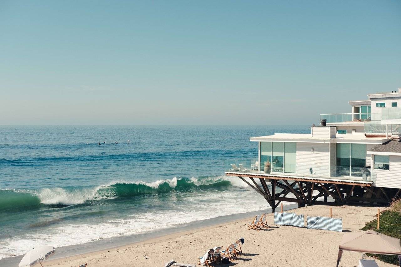
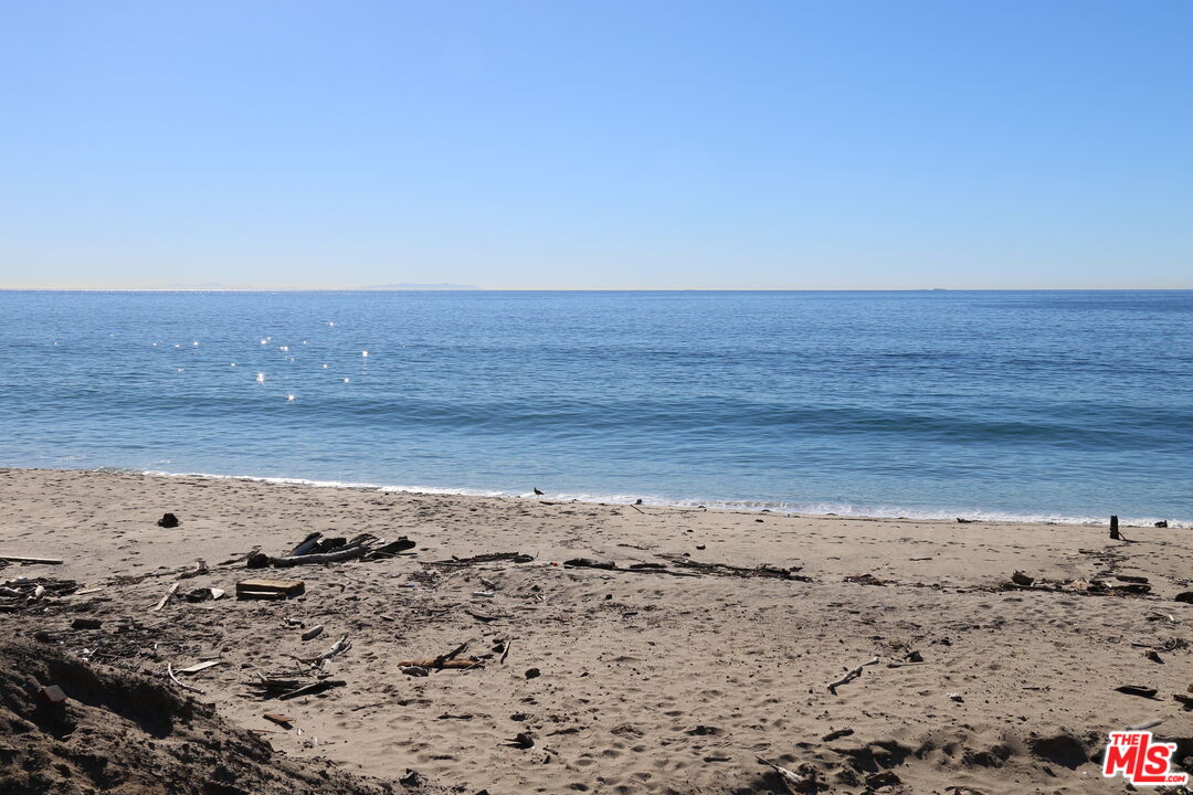
Malibu’s beaches include Surfrider Beach, Zuma Beach, Malibu State Beach, Topanga State Beach, Point Dume State Beach, and Dan Blocker Beach; its local parks include Malibu Bluffs Park (formerly Malibu Bluffs State Park), Trancas Canyon Park, Las Flores Creek Park, and Legacy Park, with neighboring parks Malibu Creek State Park, Leo Carrillo State Beach and Park, Point Mugu State Park, and the Santa Monica Mountains National Recreation Area, and neighboring state beach Robert H. Meyer Memorial State Beach, that was once part of Old Malibu (before Malibu became a city), and better known as pristine beaches, El Pescador, La Piedra, and El Matador.
History
Malibu was originally settled by the Chumash, Native Americans whose territory extended loosely from the San Joaquin Valley to San Luis Obispo to Malibu, as well as several islands off the southern coast of California. They named it “Humaliwo” or “the surf sounds loudly.” The city’s name derives from this, as the “Hu” syllable is not stressed.
Spanish explorer Juan Cabrillo is believed to have moored at Malibu Lagoon, at the mouth of Malibu Creek, to obtain fresh water in 1542. The Spanish presence returned with the California mission system, and the area was part of Rancho Topanga Malibu Sequit a 13,000-acre (53 km2) land grant in 1802. That ranch passed intact to Frederick Hastings Rindge in 1891. He and his widow, Rhoda May Rindge, guarded their privacy zealously by hiring guards to evict all trespassers and fighting a lengthy court battle to prevent the building of a Southern Pacific railroad line. Few roads even entered the area before 1929, when the state won another court case and built what is now known as the Pacific Coast Highway. By then May Rindge was forced to subdivide her property and begin selling and leasing lots. The Rindge house, known as the Adamson House (a National Register of Historic Places site and California Historical Landmark), is now part of Malibu Creek State Park and is situated between Malibu Lagoon State Beach and Surfrider Beach, beside the Malibu Pier that was originally built for the family yacht.
In 1926, in an effort to avoid selling land to stave off insolvency, Rhoda May Rindge created a small ceramic tile factory. At its height, Malibu Potteries employed over 100 workers and produced decorative tiles which furnish many Los Angeles-area public buildings and Beverly Hills residences. The factory, located one-half mile east of the pier, was ravaged by a fire in 1931. Although the factory partially reopened in 1932, it could not recover from the effects of the Great Depression and a steep downturn in Southern California construction projects. A distinct hybrid of Moorish and Arts and crafts designs, Malibu tile is considered highly collectible. Fine examples of the tiles may be seen at the Adamson House and Serra Retreat, a fifty-room mansion that was started in the 1920s as the main Rindge home on a hill overlooking the lagoon. The unfinished building was sold to the Franciscan Order in 1942 and is operated as a retreat facility, Serra Retreat. It burned in the 1970 fire and was rebuilt using many of the original tiles.
Malibu Colony was one of the first areas inhabited after Malibu was opened to the public in 1929 and it is one of Malibu’s most famous districts. It is located south of Malibu Road and the Pacific Coast Highway, west of Malibu Lagoon State Beach, and east of Malibu Bluffs Park (formerly a state park). Initially, May Rindge kept control of Malibu Beach, allowing a few wealthy Hollywood stars to build vacation homes. Nearly a decade later, money woes forced Rindge to sell the land, and the Colony was born. Long known as a popular private enclave for wealthy celebrities, the Malibu Colony today is a gated community, with multi-million dollar homes on small lots. The Colony commands breathtaking views of the Pacific Ocean, affording a spectacular coastline view stretching from Santa Monica to Rancho Palos Verdes to the south (known locally as the Queen’s Necklace) and the bluffs of Point Dume to the north.
High technology in Malibu: the first working model of a laser was demonstrated by Dr. Theodore Maiman in 1960 in Malibu at then Hughes Research Laboratory (now known as HRL Laboratories LLC). In the 1990s HRL Laboratories developed the FastScat computer code, for frequency domain algorithms and implementation, recognized as perhaps the most accurate code in the world for radar cross-section calculations. TRW built a laboratory in Solstice Canyon without any structural steel to test magnetic detectors for satellites and medical devices.
Incorporation: in 1991 most of the old Malibu land grant was incorporated as a city to allow local control of the area (as cities, unlike townships, are not subject to the same level of county government oversight). Prior to achieving municipal status, the local residents had fought several county-proposed developments, including an offshore freeway, a nuclear power plant, and several plans to replace septic tanks with sewer lines. The incorporation drive gained impetus in 1986 when the Los Angeles County Board of Supervisors approved plans for a regional sewer that would have been large enough to serve 400,000 people in the western Santa Monica Mountains. Residents were incensed that they would be assessed taxes and fees to pay for the oversized sewer project and feared that the already-capacity Pacific Coast Highway would need to be widened into a freeway to accommodate growth that they did not want. The Supervisors fought the incorporation drive and prevented the residents from voting, a decision that was overturned in courts.
The city councils that were elected in the 1990s were unable to write a Local Coastal Plan (LCP) that preserved enough public access to satisfy the California Coastal Commission, as required by the California Coastal Act. The state Legislature eventually passed a Malibu-specific law that allowed the Coastal Commission to write an LCP for Malibu, thus neutering the city’s ability to control many aspects of land use. Because of the failure to adequately address sewage disposal problems in the heart of the city, the local water board ordered Malibu in November 2009 to build a sewage plant for the Civic Center area. The city council has objected to that solution.
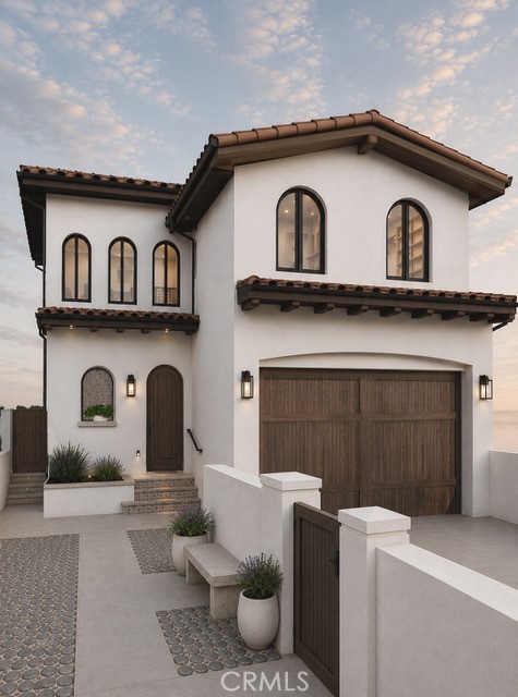
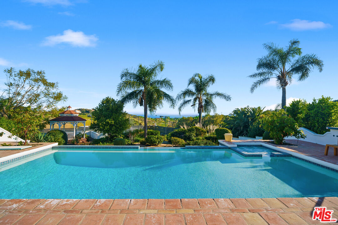
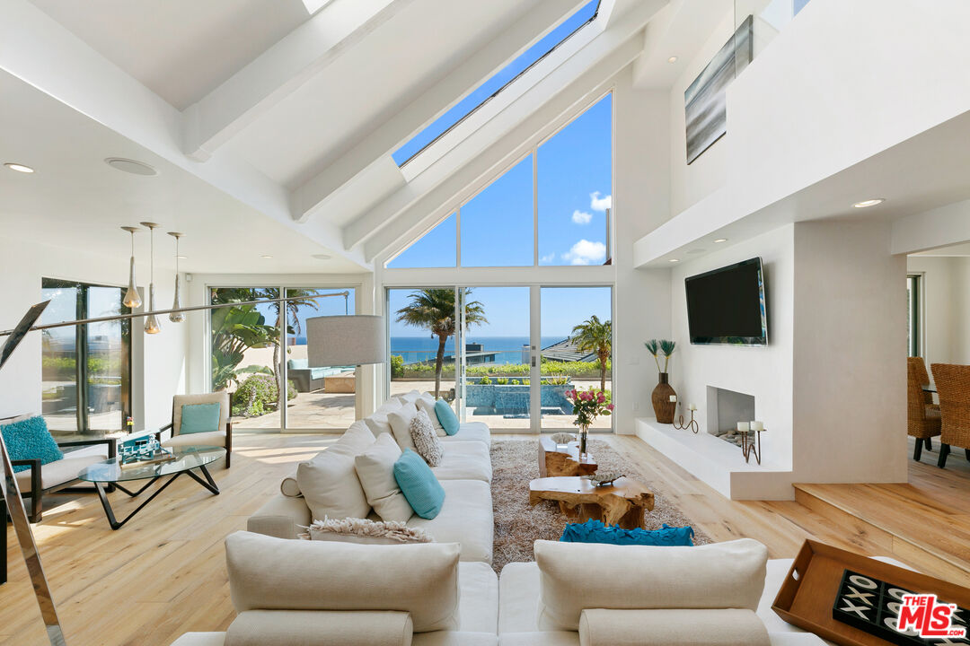
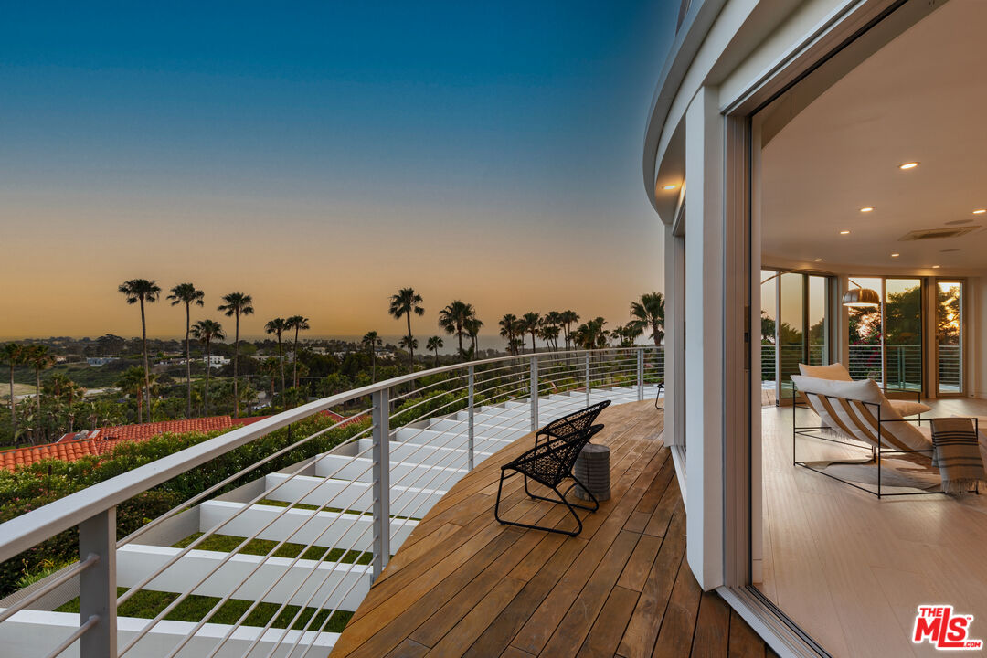
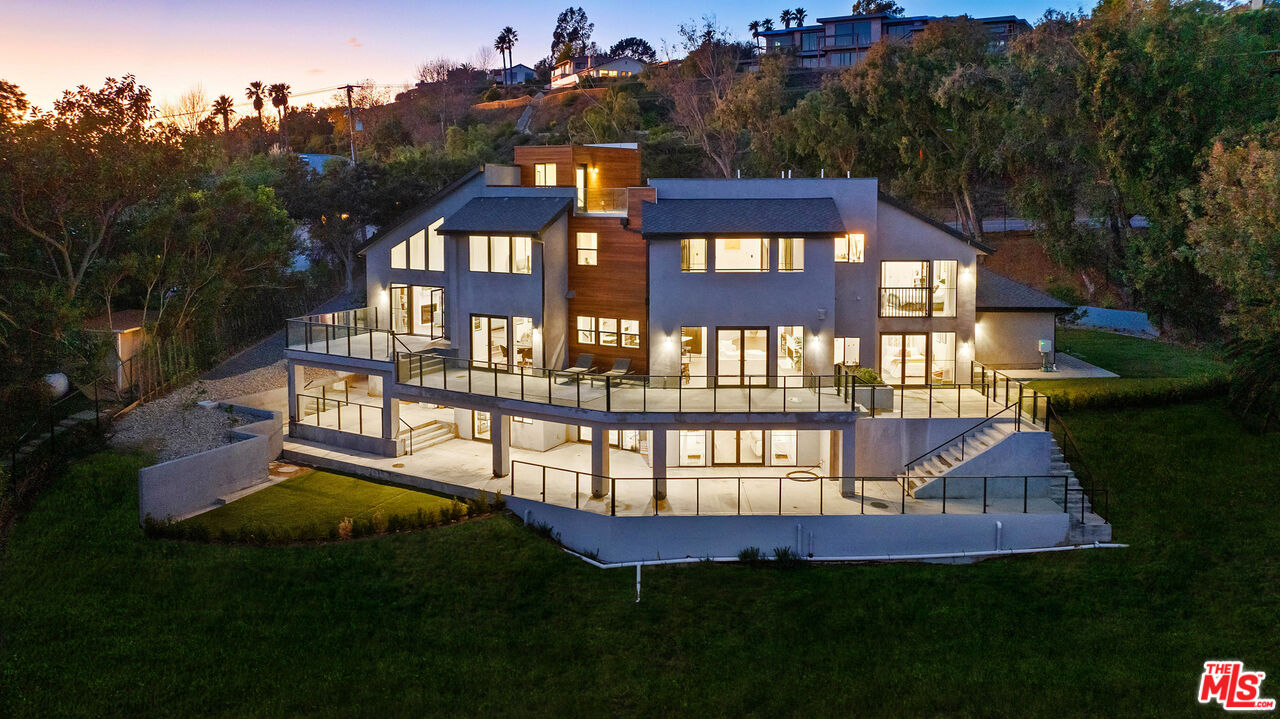
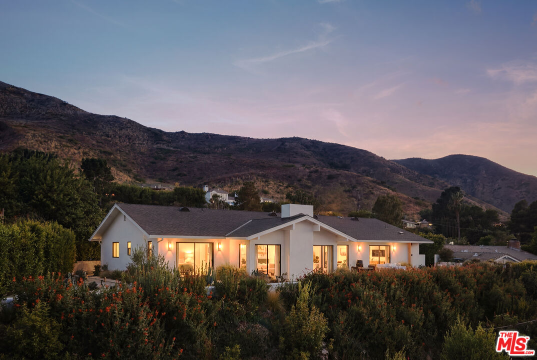
Find Your Dream Property in Malibu, CA
Search Malibu Homes for Sale